
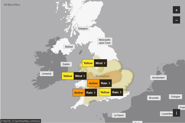
The Met Office has placed the South East under the upgraded alert as the storm moves in, replacing a yellow warning issued earlier in the week.
The difference is the amber warning signals a higher likelihood of severe impacts, including flooding, disruption to travel and a risk to life.
Between 40 and 60 millimetres of rain is expected widely across the South East, East Midlands, Wales and western England, with some areas seeing up to 80 millimetres.


The amber warning will be in force throughout Friday as rain becomes persistent and heavy. The Met Office said the worst conditions are expected over higher ground in Wales and central England.
A Met Office spokesperson said: “There is a good chance that some communities could become cut off by flooded roads. Spray and flooding will likely lead to difficult driving conditions and road closures, while train and bus services may also face delays or cancellations.”
Strong easterly winds are expected to accompany the heavy rain, with thunderstorms possible later in the day, worsening the impacts.
The storm, which was named by the Spanish Meteorological Service, is moving north-eastwards towards the UK, bringing a spell of unsettled weather to end the week.
The Met Office also warned of potential power cuts and loss of other essential services in some areas. Motorists are being advised to avoid unnecessary travel, and residents in affected regions have been urged to prepare for possible flooding.
Environment agencies are monitoring river levels closely and are expected to issue further flood alerts and warnings as conditions develop.
Comments
This article has no comments yet. Be the first to leave a comment.